A little History of Anderson Mountain Use
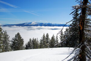
There is a long history of minimal winter motorized traffic on Anderson Mountain. The Beaverhead-Deerlodge Forest Plan designates the Anderson Mountain Area as non-motorized (both summer and winter).
The current BDNF Website lists Anderson Mountain Road as a Ski Trail. There is no mention of motorized use.
Just a few years ago there was very little snowmobile traffic on Anderson Mountain. Presently, the increased use by OSVs is creating user-conflicts, parking issues, noise pollution, and reaching a point where, according to USFS management documents, it needs to be addressed.
Snowmobile rigs are increasingly using the Chief Joseph Cross-Country Skiing parking lot and crowding out skiers.
The Beaverhead-Deerlodge Forest Plan clearly states the Anderson Mountain Area is closed both summer and winter to motorized traffic.
The Forest Service has not consistently been enforcing the non-motorized designation for the Anderson Mountain Area despite the Beaverhead-Deerlodge National Forest Plan’s directives.
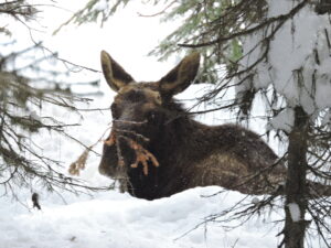
For several years, several moose have been over wintering in the Lost Trail Pass area. Lynx and wolverine have recently been sighted in the Anderson Mountain area. The rapid increase of OSV use in the area is detrimental to the wellbeing of those listed wildlife species.
Believing an increase in wintertime motorized traffic in the Anderson Mountain Area can continue without an increased escalation in user and wildlife conflicts is wishful thinking.
Anderson Mountain Area Conflicts
Regulations stipulate that conflicts do not have to be physical or even between two individuals who represent different user types (e.g., skiers v. over-snow-vehicle riders). Exchanges between different user types do not have to become a physical fight to be considered a conflict. Conflicts are between different types of recreationists such as skiers, snowshoers, fat-tire snow bicycles, hikers, hunters, snowmobiles, conversion motorcycles, etc.
Conflict is likely to be asymmetrically perceived. That is, when OSV riders and other recreationists share the same space, OSV riders may not perceive a problem, but nonmotorized recreationists do.
Examples of conflicts :
· An over-snow-vehicle (OSV) rig is parked in the Chief Joseph parking lot, taking up 5-6 parking spots that would otherwise be used by vehicles driven by skiers which require less space
· An OSV leaves a rut that makes skiing more difficult
· An OSV rider harasses or disturbs other recreationists or their animals (dogs)
· Unwanted noise or the smell of exhaust from OSVs.
· A trail typically used by skiers, hikers, or people on snowshoes is frequented by OSVs
· OSV incursions into areas reserved for non-motorized recreation
· An OSV rider harassing wildlife or disturbing other Forest Service resources
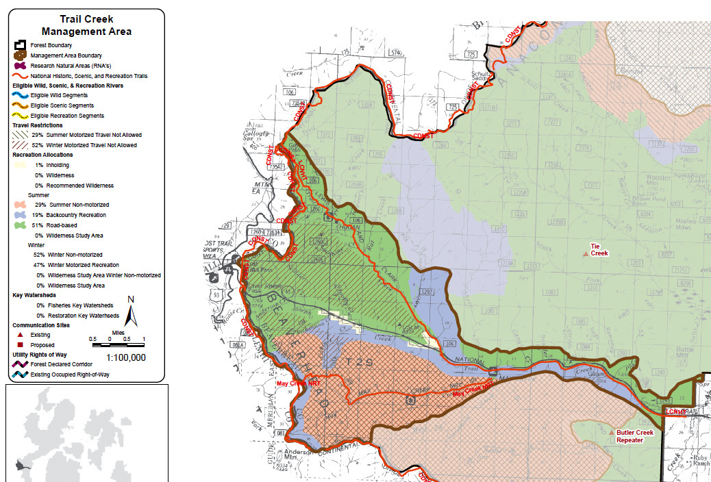
In the area on and around Anderson Mountain, some areas are listed as winter non-motorized. South of Highway 43, the area east of Anderson Mountain Road is winter non-motorized. Therefore, any OSVs or tracks from OSVs east of Anderson Mountain Road indicate illegal incursions and should be reported.
The entire area east of Gibbons Pass Road (FR 1260) between the snowmobile parking lot and the northernmost trail into the Chief Joseph Ski Area is classified as winter non-motorized. Any OSVs or tracks from OSVs in that area east of Gibbons Pass Road indicate illegal incursions and should be reported.
Most of the area enclosed by Gibbon Pass Road (FR-1260), Trail Creek Road (FR-106), and Highway 43 is off limits to OSVs. However, there are limited places within that area that are open to OSV use – area near Hogan Cabin, narrow strips along Gibbons Pass Road and Trail Creek Road, and Highway 43. The Shoofly Creek ski trail is not open to OSV use. (see attached map for more details)
How to Report
Send your reports to andersonmountainquietuse@gmail.com. We will compile them and send them on to the Forest Service.
All reports should include:
- Your name
- date
- time
- location (a GPS location is helpful but not required)
If you have these items, add them
- Pictures
- License Plate numbers (pictures)
- Name of the person(s) causing conflicts or illegal activities (if possible) Email incident reports to: andersonmountainquietuse@gmail.com
